
"Hiç şüphesiz ki Antalya dünyanın en güzel yeridir"
Mustafa Kemal ATATÜRK
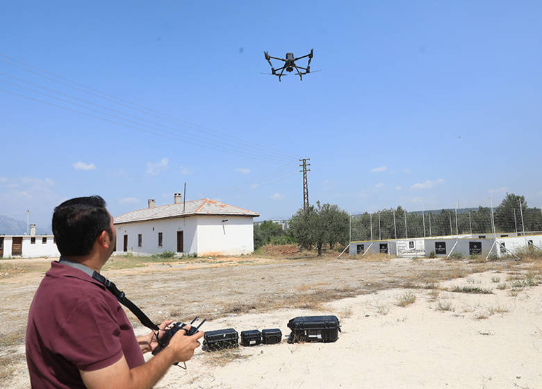
Antalya Büyükşehir Belediyesi, mühendislik hizmetlerinde ihtiyaç duyduğu haritaları ve coğrafi veri teminini insansız hava aracı desteğiyle sağlamaya başladı. Bu kapsamda belediye personeline İnsansız Hava Aracı ile Coğrafi Veri Üretimi Bilgilendirme toplantısı gerçekleştirildi.
Antalya Büyükşehir Belediyesi, günümüz teknolojik gelişmelerine bağlı olarak iş ve işlemlerinde hizmet ve verimlilik kalitesinin artırılması yönünde adımlar atarak kamu hizmetlerinde insansız hava araçlarını kullanmaya başladı. Bu kapsamda belediye toplantı salonunda ilgili personele bilgilendirme toplantısı düzenlendi. Toplantıda Bilgi İşlem Dairesi Başkanlığı Coğrafi Bilgi Sistemleri Şube Müdürlüğü’nce kullanılmaya başlanılan, haritalama çalışmalarına yönelik geliştirilmiş RTK/GPS sistemine sahip İnsansız Hava Aracı ile havadan ekonomik, hızlı ve yüksek doğruluklu haritalar üretilerek birimlerin mühendislik çalışmalarındaki iş ve işlemlerinde ihtiyaç duydukları güncel verilerin temin edilmesi konuları personellere aktarıldı.
HEM EKONOMİK HEM HIZLI
Büyükşehir Belediyesi, mühendislik projelerinden, mimari projelerine, imar planlarından, parselasyon planlarına kadar birçok çalışmanın en temel altlığı olan sayısal halihazır haritaların doğruluk ve hassasiyetle insansız hava aracıyla üretimini gerçekleştirecek. İnsansız Hava Aracı kullanılarak Fotogrametrik Ölçme Yöntemiyle üretilen sayısal ortofoto ve hâlihazır haritalar ile sayısal arazi modellerinin diğer yersel ölçme yöntemleri ile üretilen haritalar ile karşılaştırıldığında istenilen hassasiyet de ve doğrulukta olduğu tespit edildi. Zaman ve maliyet açısından da ele alındığında kamu kaynaklarının doğru, etkin, yerinde ve verimli kullanılması yönünden de Belediye’ye ekonomik açıdan büyük katkı sağlayacağı ön görülüyor.
Ayrıca arazilerin ve yapıların 3 boyutlu harita modellerinin de üretilmesi yakın zamanda başlatılarak, Antalya’nın kent bilgi sistemi içerisinde bulunan dijital şehir envanterine coğrafi katman olarak yer alması çalışmaları planlanıyor.
Alanya, Türkiye'nin Akdeniz Bölgesi'deki Antalya iline bağlı bir turizm ilçesidir. Şehir merkezine uzaklığı 154 kilometredir. Türkiye'nin güney sahillerinde bulunan Alanya, 1.598,51 km²'lik bir alana sahiptir ve 2015'te nüfusu 291.643 kişidir.
Daha iyi bir kullanıcı deneyimi için geliştirdiğimiz mobil uygulamamıza göz atın